Personnel resources from the GLAD Workshop:
The University of Maine Center for Innovation in Teaching and Learning
The University of Maine at Farmington Teaching and Learning Collaborative; Mary Dindorf
For campus-specific geospatial technologies resources, please contact Eileen Moran of the Maine Geospatial Institute
Videos from the GLAD Workshop:
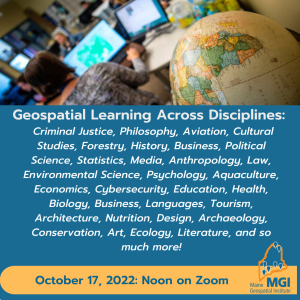
Geospatial Across Learning Faculty Workshop Event, October 17, 2022
Faculty Flash Talks:
| Video Title | Presenter | About |
|---|---|---|
| Video 1 Using Story Maps for media-immersive long-scrolling articles | Stephen Grandchamp | Assistant Professor for Literature and Digital Humanities, UMF Digital Humanities Lab, University of Maine at Farmington |
| Video 2 Digital and Spatial History | Anne Knowles | McBride Professor of History and Graduate Coordinator, University of Maine |
| Video 3 Refugees Through Maps | Nicholas Micinski | Assistant Professor of Political Science and International Affairs, University of Maine |
| Video 4 Folk Item Collections | Karen Miller | Faculty Associate in the Department of Anthropology, University of Maine |
| Video 5 Geospatial Applications and UMF Archaeology | Lucas Kellett | Associate Professor of Archaeology, University of Maine at Farmington |
| Video 6 Using Survey123 for Project-based Learning | Matt McCourt | Associate Professor Geography and Environmental Planning, University of Maine at Farmington |
| Video 7 Adapting Geo Inquiries for Oceanography | Tora Johnson | Director of the GIS Laboratory and Service Center/Chair of the Environmental and Biological Sciences Division, University of Maine at Machias |
| Video 8 Geospatial Tools for Change Detection | Kristin Schild | Assistant Professor in the School of Earth and Climate Sciences, University of Maine |
| Video 9 Reflections on BIO 100 GIS Pilot | Julia McGuire | Lecturer and Introductory Biology Lab Supervisor in the Department of Biology and Ecology, University of Maine |
UMaine System Guides:
Logging in to ArcGIS Online with Single Sign On (SSO)
Adding an ArcGIS Online map to a Google Site
Industry Resources:
ESRI Blog (Help, ideas, and primers, like Getting started with…climate models)
Climate Education Resources:
Maine Climate Change Adaptation Providers Network
Natural Resources Council of Maine
State of Maine Resources:
Maine Won’t Wait Report: Climate Council, 2020. A 4 year plan centered on the following:
- Achieving emissions reductions goals laid out in Maine law — a 45% reduction by 2030 and 80% by 2050.
- Creating economic opportunity as part of climate and energy transitions.
- Preparing communities, people, and economy for the impacts of climate change.
- Advancing equity to ensure communities and citizens who are often left behind can benefit from climate solutions by having access to opportunities and protection from threats
Climate Tools:
Examples of climate change vulnerability, risk, and adaptation assessment tools
| Name/type of tool | Purpose | |
|---|---|---|
| Risk and adaptation decision-making frameworks (process orientated) | ||
| UKCIP Adaptation Wizard | A guided five-step process to aid organizations to assess their vulnerability to climate change and aid adaptation planning | |
| Adaptation support tool from Climate-ADAPT | Assists users in developing climate change adaptation policies by providing guidance and links to relevant sources and tools. Based on the UKCIP Adaptation Wizard and other risk assessment frameworks | |
| Portals or platforms | ||
| World Bank Climate Change Data Portal | “One stop shop” for climate-related data and tools. Produces map output, online summaries and links to additional tools | |
| weADAPT | Portal to a range of tools for assisting climate change adaptation | |
| Climate Mapper | Maps and visualizes climate model data for onward use by a wider user community to improve vulnerability assessments | |
| Adaptation Learning Mechanism (ALM) | A knowledge-sharing platform providing an information database of resources on adaptation knowledge | |
| Climate-ADAPT | The European Climate Adaptation Platform is a portal to a large amount of information and includes tools such as the adaptation support tool, case study search and map viewer | |
| General vulnerability, risk, or impact assessment techniques | ||
| Social Vulnerability Index for the USA | A comparative metric that facilitates the examination of geographic variation in social vulnerability and an indicator of disaster recovery | |
| Severe Weather Impacts Monitoring System (SWIMS) | Online data capture tool enabling users to record impacts and responses to assess vulnerability to severe weather events | |
| Climate Wizard | Shows historical and future climate projections for technical and nontechnical audiences and enables spatial data download | |
Cavan G., Butlin T., Gill S., Kingston R., Lindley S. (2015) Web-GIS Tools for Climate Change Adaptation Planning in Cities. In: Leal Filho W. (eds) Handbook of Climate Change Adaptation. Springer, Berlin, Heidelberg. https://doi.org/10.1007/978-3-642-38670-1_106